As the UK braces for an unsettled week, the latest forecasts predict heavy rain and strong winds, affecting the southern regions. Here’s what you need to know to stay safe and prepared
Rainfall Warnings Take Effect:
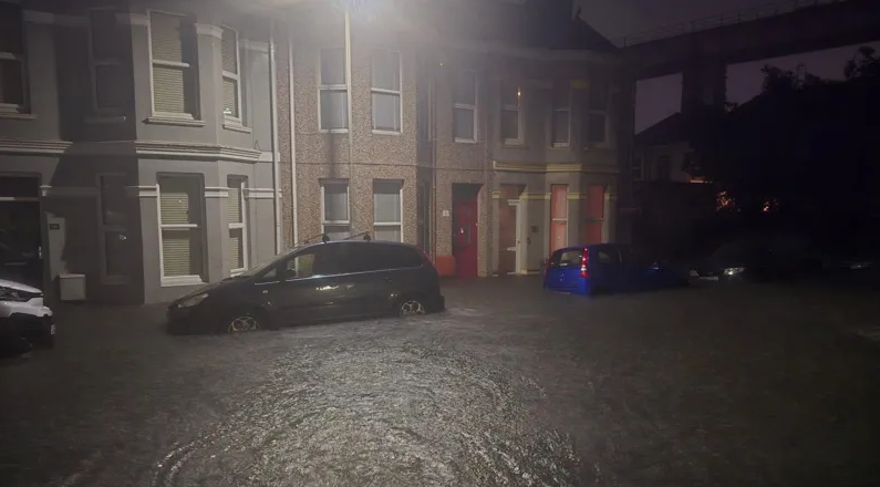
The Met Office has issued a Yellow Weather Warning for rain, which will be in place from midnight to 2 PM on Wednesday. This warning covers a wide area, including Cornwall, Devon, and the south coast of England, as well as parts of south Wales. The forecast suggests heavy showers, thunderstorms, and even coastal gales, which could result in localized flooding and travel disruption.
Rainfall Details:
- Widespread rain totals of 20-30mm are expected.
- Some areas could see as much as 40-60mm of rainfall within just six to nine hours.
- Coastal areas along the English Channel may experience high winds and rough conditions.
Rebekah Hicks, Chief Meteorologist at the Met Office, noted:
“This weather system coincides with the first school run after summer holidays, making the start of the day particularly wet and disruptive for many.”
Looking Ahead: A Mixed Forecast
- Thursday: A day of scattered showers, occasional thunderstorms, and brisk winds. Rain may become more persistent in parts of western Scotland.
- Friday: The south will see improving weather with sunny spells, while the northwest remains wet and windy, with a possibility of coastal gales.
Safety Tips and Resources
To stay safe during this period of unsettled weather:
- Monitor Local Warnings: Keep an eye on updates from the Met Office and Environment Agency.
- Travel Wisely: Avoid flooded roads and plan for delays during peak commute times.
- Prepare Your Property: Take precautions to protect your home in case of flooding.
For the latest updates, visit the Met Office or follow major outlets like the BBC for real-time information.
Stay safe, stay dry, and let’s hope for brighter skies ahead!